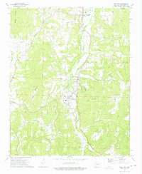
1973 Map of West Fork
USGS Topo · Published 1976About this map
West Fork and Greenland serve as the primary anchors of this Ozark landscape, where the St Louis - San Francisco railroad and the West Fork White River parallel one another through a winding valley. This 1973 survey details a rural Washington County environment transitionally caught between traditional agriculture and modern infrastructure, evidenced by the presence of a Substation, Sewage Disposal Pond, and a prominent Pipeline cutting across the northwestern ridges. Local genealogy is well-documented through a series of family and community landmarks, such as Boone Cem, the Campbell Ch Cem, and the small settlement of Woolsey. Elevations are defined by significant peaks like Bloyd Mountain and West Mountain, which enclose the river corridor. The map provides a precise look at the area's social fabric before extensive modern expansion, preserved here through the location of country houses, the High Sch at West Fork, and outlying quarries.
Find a feature on this map
44 named features on this map. Tap any name to fly to it.
Don’t see what you’re looking for? This feature index may not catch every label — zoom into the map to look around manually.
Map Details
Editions of this 1973 West Fork Map
3 editions found
Other maps of this area

1898 · Winslow
USGS Topo · 1:125,000

1899 · Fayetteville
USGS Topo · 1:125,000

1901 · Winslow
USGS Topo · 1:125,000

1901 · Fayetteville
USGS Topo · 1:125,000

1904 · Fayetteville
USGS Topo · 1:125,000

1946 · Fort Smith
USGS Topo · 1:250,000

1954 · Tulsa
USGS Topo · 1:250,000

1958 · Fayetteville
USGS Topo · 1:24,000

1958 · Elkins
USGS Topo · 1:24,000

1958 · Tulsa
USGS Topo · 1:250,000