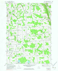
1970 Map of West Groton
USGS Topo · Published 1983About this map
Lansing and Groton townships define this rural landscape of central New York, where the Lehigh Valley railroad cuts through the valley of the Owasco Inlet. The map reveals a dense network of nineteenth-century hamlets and crossroads, many named for local families, including Van Ostrand Corners, Munson Corners, and Howland Corners. The presence of the South Lansing School for Girls and the Cornell University Radiation Biology Laboratory indicates a specialized land use pattern near the southern boundary. Farming remains the dominant character of the terrain, though the rugged Bear Swamp and hills like Lobdell Hill break the grid of township roads. Genealogists will find significant value in the identified rural burial grounds, such as Stearns Cem and the Cobb Street Cem, which anchor the histories of the surrounding farmsteads.
Find a feature on this map
60 named features on this map. Tap any name to fly to it.
Don’t see what you’re looking for? This feature index may not catch every label — zoom into the map to look around manually.
Map Details
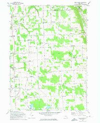
Editions of this 1970 West Groton Map
2 editions found
Other maps of this area

1893 · Ithaca
USGS Topo · 1:62,500

1895 · Ithaca
USGS Topo · 1:62,500

1898 · Moravia
USGS Topo · 1:62,500

1900 · Dryden
USGS Topo · 1:62,500

1902 · Moravia
USGS Topo · 1:62,500

1902 · Genoa
USGS Topo · 1:62,500

1905 · Watkins Glen
USGS Topo · 1:125,000

1906 · Catatonk
USGS Topo · 1:125,000

1942 · Ludlowville
USGS Topo · 1:24,000

1942 · Groton
USGS Topo · 1:24,000