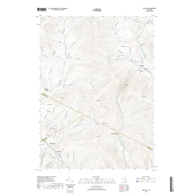
2019 Map of West Kill
USGS Topo · Published 2019About this map
Halcott Center and West Kill anchor the northern reaches of this Catskill Mountain terrain, where deep drainage valleys like Johnson Hollow and Hemlock Gully dictate the placement of local roads. The landscape is defined by its high peaks, including Halcott Mtn and Balsam Mtn, which separate the various watercourse settlements. Local history is preserved in small family and community burial grounds such as Schermerhorn Cem and the Elk Creek Cem, often located near the winding roads that follow the valley floors.
Find a feature on this map
95 named features on this map. Tap any name to fly to it.
Don’t see what you’re looking for? This feature index may not catch every label — zoom into the map to look around manually.
Map Details
Editions of this 2019 West Kill Map
This is the sole edition of this map. No revisions or reprints were ever made.
Other maps of this area

1900 · Phoenicia
USGS Topo · 1:62,500

1901 · Margaretville
USGS Topo · 1:62,500

1901 · Gilboa
USGS Topo · 1:62,500

1903 · Gilboa
USGS Topo · 1:62,500

1903 · Phoenicia
USGS Topo · 1:62,500

1904 · Hobart
USGS Topo · 1:62,500

1904 · Margaretville
USGS Topo · 1:62,500
1945 · Seager
USGS Topo · 1:24,000

1945 · West Kill
USGS Topo · 1:24,000

1945 · Fleischmanns
USGS Topo · 1:24,000