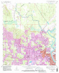
1994 Map of West Monroe North
USGS Topo · Published 1995About this map
The Ouachita River defines the eastern boundary of this mid-1990s landscape, where the urban expansion of West Monroe meets the low-lying wetlands of the Bayou Country. Residential growth is evident in settlements like Claiborne and Drew, while the infrastructure of the Monroe Gas Field and various pipelines reveal the area's industrial foundations. The map provides significant genealogical value, documenting numerous community anchors such as Hasley Cem, Drew Cem, and Nash Cem, alongside local spiritual centers like Goodhope Ch and Chapel Hill Ch.
Find a feature on this map
54 named features on this map. Tap any name to fly to it.
Don’t see what you’re looking for? This feature index may not catch every label — zoom into the map to look around manually.
Map Details
Editions of this 1994 West Monroe North Map
This is the sole edition of this map. No revisions or reprints were ever made.
Other maps of this area

1935 · Drew
USGS Topo · 1:62,500

1940 · Monroe
USGS Topo · 1:62,500

1952 · Calhoun
USGS Topo · 1:62,500

1953 · Chatham
USGS Topo · 1:62,500

1955 · Shreveport
USGS Topo · 1:250,000

1956 · Shreveport
USGS Topo · 1:250,000

1957 · Monroe North
USGS Topo · 1:62,500

1957 · West Monroe North
USGS Topo · 1:24,000

1957 · West Monroe South
USGS Topo · 1:24,000

1957 · Monroe South
USGS Topo · 1:24,000