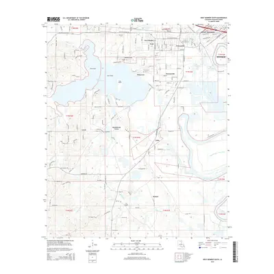
2015 Map of West Monroe South
USGS Topo · Published 2015About this map
The Ouachita River snakes through the eastern half of this Ouachita Parish landscape, defining the boundaries of industrial and residential growth south of West Monroe. The area is a complex network of waterways, where the meandering Bayou Mouchoir De L'Ourse and Cheniere Creek meet the river among low-lying islands like Coon Island and Pine Island. These wetlands are bordered by several established communities, including Bawcomville, Brownsville, and Ridgecrest.
Find a feature on this map
159 named features on this map. Tap any name to fly to it.
Don’t see what you’re looking for? This feature index may not catch every label — zoom into the map to look around manually.
Map Details
Editions of this 2015 West Monroe South Map
This is the sole edition of this map. No revisions or reprints were ever made.
Other maps of this area

1935 · Drew
USGS Topo · 1:62,500

1940 · Monroe
USGS Topo · 1:62,500

1952 · Calhoun
USGS Topo · 1:62,500

1953 · Chatham
USGS Topo · 1:62,500

1955 · Shreveport
USGS Topo · 1:250,000

1956 · Shreveport
USGS Topo · 1:250,000

1957 · Monroe North
USGS Topo · 1:62,500

1957 · West Monroe North
USGS Topo · 1:24,000

1957 · West Monroe South
USGS Topo · 1:24,000

1957 · Monroe South
USGS Topo · 1:24,000