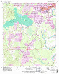
1994 Map of West Monroe South
USGS Topo · Published 1995About this map
Cheniere Brake dominates the western landscape of this mid-1990s survey, its waters punctuated by Pine Island, Joes Island, and Coon Island. East of this wetland complex, the suburban expansion of Brownville and Bawcomville reveals a densifying residential grid near the Ouachita River. This map captures a significant period of late-century development, where new additions in purple highlight the growth of neighborhoods around Siegle and Wilds. Genealogists will find a high density of rural burial sites and places of worship, including the Old Sardis and New Sardis cemeteries, and the St Lukes and Mt Vernon churches. The transition from the riverbottom industry and levees of the Ouachita River to the timbered bayous of Cheniere Creek and Steep Bayou illustrates the local reliance on both the river system and the high ground of the surrounding pine woods.
Find a feature on this map
46 named features on this map. Tap any name to fly to it.
Don’t see what you’re looking for? This feature index may not catch every label — zoom into the map to look around manually.
Map Details
Editions of this 1994 West Monroe South Map
This is the sole edition of this map. No revisions or reprints were ever made.
Other maps of this area

1935 · Drew
USGS Topo · 1:62,500

1940 · Monroe
USGS Topo · 1:62,500

1952 · Calhoun
USGS Topo · 1:62,500

1953 · Chatham
USGS Topo · 1:62,500

1955 · Shreveport
USGS Topo · 1:250,000

1956 · Shreveport
USGS Topo · 1:250,000

1957 · Monroe North
USGS Topo · 1:62,500

1957 · West Monroe North
USGS Topo · 1:24,000

1957 · West Monroe South
USGS Topo · 1:24,000

1957 · Monroe South
USGS Topo · 1:24,000