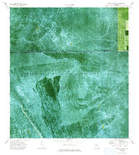
1974 Map of West Of Deem City
USGS Topo · Published 1993About this map
Everglades Wildlife Management Area dominates this orthophotomap, which utilizes aerial photography to document the intricate hydrologic patterns of the northern Everglades. The landscape is defined by the heavy infrastructure of water control, most notably the Miami Canal and the artificial boundaries of Conservation Area No 3A. This particular area is noted for having water impounded periodically, reflecting the mid-1970s management of Florida’s wetlands for flood control and water storage. Visible transport patterns are restricted to the water, where a web of Airboat Trails crisscrosses the sawgrass and sloughs. The map also captures the precise boundary between Palm Beach Co and Broward Co, providing a clear record of how political lines were surveyed across this seasonally flooded terrain before modern development pressures reached this far west.
Find a feature on this map
6 named features on this map. Tap any name to fly to it.
Don’t see what you’re looking for? This feature index may not catch every label — zoom into the map to look around manually.
Map Details
Editions of this 1974 West Of Deem City Map
2 editions found
Other maps of this area

1956 · West Palm Beach
USGS Topo · 1:250,000

1957 · West Palm Beach
USGS Topo · 1:250,000

1958 · West Palm Beach
USGS Topo · 1:250,000

1973 · Everglades 4 NW
USGS Topo · 1:24,000

1973 · Everglades 4 NE
USGS Topo · 1:24,000

1973 · Everglades 3 NE
USGS Topo · 1:24,000

1974 · Everglades 1 SW
USGS Topo · 1:24,000

1974 · Everglades 2 SE
USGS Topo · 1:24,000

1974 · Everglades 1 NW
USGS Topo · 1:24,000

1974 · Everglades 1 SE
USGS Topo · 1:24,000