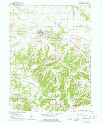
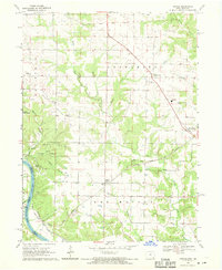
1964 Map of West Point
USGS Topo · Published 1977About this map
West Point sits at a geographic crossroads in Lee County, where the plateau of Pleasant Ridge transitions into the dissected drainages of the Sugar Creek and Pitman Creek systems. This mid-1960s survey, updated with mid-1970s revisions, reveals a landscape deeply connected to its early settlement history through a dense network of family and parish graveyards including Calvary Cem, St Peters Cem, and the remote Whorton Cem.
Find a feature on this map
27 named features on this map. Tap any name to fly to it.
Don’t see what you’re looking for? This feature index may not catch every label — zoom into the map to look around manually.
Map Details
Editions of this 1964 West Point Map
2 editions found
Other maps of this area

1936 · Fort Madison
USGS Topo · 1:62,500

1958 · Burlington
USGS Topo · 1:250,000

1961 · Burlington
USGS Topo · 1:250,000

1963 · Burlington
USGS Topo · 1:250,000
1964 · Nauvoo
USGS Topo · 1:24,000

1964 · West Point
USGS Topo · 1:24,000
1964 · Niota
USGS Topo · 1:24,000
1964 · Fort Madison
USGS Topo · 1:24,000
1968 · Argyle
USGS Topo · 1:24,000

1968 · Donnellson
USGS Topo · 1:24,000