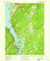
1957 Map of West Point
USGS Topo · Published 1973About this map
U S Military Academy West Point dominates the western bank of the Hudson River in this 1957 survey, showing the complex layout of The Parade, Michie Stadium, and the historic heights of Fort Putnam. Across the water, the industrial and residential corridors of Beacon and Cold Spring are connected by the New York Central railroad and State Highway 9D.
Find a feature on this map
102 named features on this map. Tap any name to fly to it.
Don’t see what you’re looking for? This feature index may not catch every label — zoom into the map to look around manually.
Map Details
Editions of this 1957 West Point Map
4 editions found
Other maps of this area

1892 · West Point
USGS Topo · 1:62,500

1893 · Poughkeepsie
USGS Topo · 1:62,500

1894 · West Point
USGS Topo · 1:62,500

1894 · Poughkeepsie
USGS Topo · 1:62,500

1899 · West Point
USGS Topo · 1:62,500

1901 · West Point
USGS Topo · 1:62,500

1902 · Schunemunk
USGS Topo · 1:62,500

1903 · Poughkeepsie
USGS Topo · 1:62,500

1903 · Newburg
USGS Topo · 1:62,500

1930 · Schunemunk
USGS Topo · 1:48,000