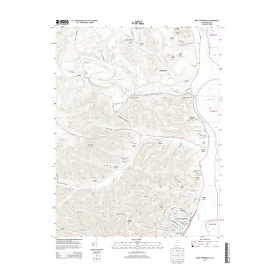
2013 Map of West Portsmouth
USGS Topo · Published 2013About this map
Tremper Mound stands as a significant archaeological landmark near the banks of the Scioto River, illustrating the deep indigenous history that precedes the modern settlements of Scioto County. The landscape is defined by the winding course of Scioto-Brush Creek, which flows past communities like McDermott and Rushtown before its confluence with the larger river. These valleys are densely populated with small family and community burial grounds, such as the Mershon Swords Cem, Lute Cem, and Holy Trinity Roman Catholic Cem, providing essential primary-source data for genealogists tracing local lineages.
Find a feature on this map
126 named features on this map. Tap any name to fly to it.
Don’t see what you’re looking for? This feature index may not catch every label — zoom into the map to look around manually.
Map Details
Editions of this 2013 West Portsmouth Map
This is the sole edition of this map. No revisions or reprints were ever made.
Other maps of this area

1911 · Sciotoville
USGS Topo · 1:62,500

1913 · Sciotoville
USGS Topo · 1:62,500

1915 · Garrison
USGS Topo · 1:62,500

1915 · Otway
USGS Topo · 1:62,500

1917 · Otway
USGS Topo · 1:62,500

1918 · Garrison
USGS Topo · 1:62,500

1926 · Greenup
USGS Topo · 1:48,000

1930 · Greenup
USGS Topo · 1:62,500

1949 · Pond Run
USGS Topo · 1:24,000

1949 · Friendship
USGS Topo · 1:24,000