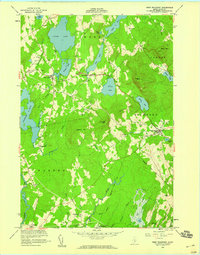
1955 Map of West Rockport
USGS Topo · Published 1959About this map
Goulds Hospital and small village clusters define the mid-century landscape of these midcoast Maine towns. The interior of Knox County is characterized by a high density of water bodies and prominent peaks, including Ragged Mtn and Bald Mtn, which frame the settled valleys. Small industrial and community sites are visible, such as Wattons Mill and several unnamed Cem locations near East Warren.
Find a feature on this map
43 named features on this map. Tap any name to fly to it.
Don’t see what you’re looking for? This feature index may not catch every label — zoom into the map to look around manually.
Map Details
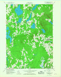
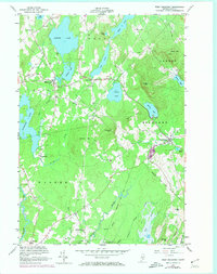
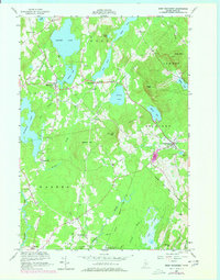
Editions of this 1955 West Rockport Map
5 editions found

Other maps of this area

1904 · Rockland
USGS Topo · 1:62,500

1906 · Rockland
USGS Topo · 1:62,500

1913 · Waldoboro
USGS Topo · 1:48,000

1915 · Waldoboro
USGS Topo · 1:62,500

1915 · Belfast
USGS Topo · 1:62,500

1916 · Liberty
USGS Topo · 1:62,500

1917 · Belfast
USGS Topo · 1:62,500

1941 · Belfast
USGS Topo · 1:62,500

1941 · Rockland
USGS Topo · 1:62,500

1941 · Waldoboro
USGS Topo · 1:62,500