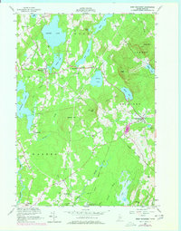
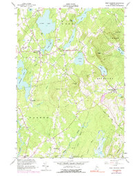
1955 Map of West Rockport
USGS Topo · Published 1978About this map
Alford Lake and the surrounding mid-coast highlands define this 1955 survey of Knox County, where the topography transitions from the waters of Crawford Pond to prominent peaks like Ragged Mtn and Spruce Mtn. The landscape is a network of small mill settlements and crossroads communities such as West Rockport and South Hope, connected by winding roads and early utility corridors like the Telephone line. The local economy and history are visible in features like Wattons Mill on Quiggle Brook and the presence of Goulds Hospital.
Find a feature on this map
49 named features on this map. Tap any name to fly to it.
Don’t see what you’re looking for? This feature index may not catch every label — zoom into the map to look around manually.
Map Details
Editions of this 1955 West Rockport Map
5 editions found
Other maps of this area

1904 · Rockland
USGS Topo · 1:62,500

1906 · Rockland
USGS Topo · 1:62,500

1913 · Waldoboro
USGS Topo · 1:48,000

1915 · Waldoboro
USGS Topo · 1:62,500

1915 · Belfast
USGS Topo · 1:62,500

1916 · Liberty
USGS Topo · 1:62,500

1917 · Belfast
USGS Topo · 1:62,500

1941 · Belfast
USGS Topo · 1:62,500

1941 · Rockland
USGS Topo · 1:62,500

1941 · Waldoboro
USGS Topo · 1:62,500