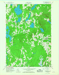
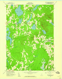
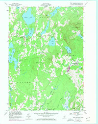
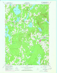
1955 Map of West Rockport
USGS Topo · Published 1967About this map
Alford Lake and Crawford Pond dominate the western edge of this mid-century coastal interior landscape, where the towns of Union, Hope, and Rockport meet. The settlement pattern follows narrow valleys between prominent peaks like Ragged Mtn and Bald Mtn, with small crossroads communities such as South Hope and East Union serving as local hubs. This 1955 field-checked survey reveals an era before significant suburban expansion, where local industry is still tethered to the water, evidenced by Wattons Mill on Quiggle Brook and the presence of numerous Borrow Pits near West Rockport. The intricate drainage system of the St George River and the West Branch Oyster River shapes the southern reaches of the quadrangle, while the Rockland City Bdy clips the eastern edge near Hosmer Pond.
Find a feature on this map
44 named features on this map. Tap any name to fly to it.
Don’t see what you’re looking for? This feature index may not catch every label — zoom into the map to look around manually.
Map Details
Editions of this 1955 West Rockport Map
5 editions found

Other maps of this area

1904 · Rockland
USGS Topo · 1:62,500

1906 · Rockland
USGS Topo · 1:62,500

1913 · Waldoboro
USGS Topo · 1:48,000

1915 · Waldoboro
USGS Topo · 1:62,500

1915 · Belfast
USGS Topo · 1:62,500

1916 · Liberty
USGS Topo · 1:62,500

1917 · Belfast
USGS Topo · 1:62,500

1941 · Belfast
USGS Topo · 1:62,500

1941 · Rockland
USGS Topo · 1:62,500

1941 · Waldoboro
USGS Topo · 1:62,500