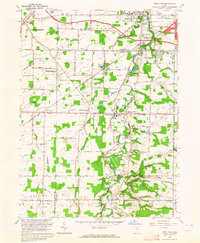
1963 Map of West View
USGS Topo · Published 1964About this map
Butternut Ridge serves as a prominent natural landmark in this early 1960s landscape, where the rural character of Lorain and Cuyahoga counties is punctuated by growing residential pockets and established agricultural crossroads. The New York Central and Baltimore and Ohio railroads anchor the industrial and transport identity of the region, connecting small settlements like Columbia Station and West View.
Find a feature on this map
61 named features on this map. Tap any name to fly to it.
Don’t see what you’re looking for? This feature index may not catch every label — zoom into the map to look around manually.
Map Details
Editions of this 1963 West View Map
3 editions found
Other maps of this area

1901 · Oberlin
USGS Topo · 1:62,500

1902 · Berea
USGS Topo · 1:62,500

1903 · Oberlin
USGS Topo · 1:62,500

1904 · Berea
USGS Topo · 1:62,500

1904 · Medina
USGS Topo · 1:62,500

1904 · Wellington
USGS Topo · 1:62,500

1906 · Medina
USGS Topo · 1:62,500

1906 · Wellington
USGS Topo · 1:62,500

1950 · Cleveland
USGS Topo · 1:250,000

1953 · West View
USGS Topo · 1:24,000