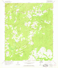
1959 Map of Westover
USGS Topo · Published 1969About this map
Westover serves as the primary hub of activity in this Shelby County landscape, where the Atlantic Coast Line railroad and the Florida Short Route converge to define the local infrastructure. The terrain is characterized by the prominent ridges of Double Mountain and Straight Ridge to the north, giving way to a dense network of creek branches and swamps. This survey captures a rural Alabama community deeply rooted in its local congregations, evidenced by a high density of country churches including Mt Tabor Ch, Mt Zion Ch, and Union Ch.
Find a feature on this map
36 named features on this map. Tap any name to fly to it.
Don’t see what you’re looking for? This feature index may not catch every label — zoom into the map to look around manually.
Map Details
Editions of this 1959 Westover Map
4 editions found
Other maps of this area

1890 · Bessemer
USGS Topo · 1:125,000

1890 · Talladega
USGS Topo · 1:125,000

1892 · Talladega
USGS Topo · 1:125,000

1892 · Bessemer
USGS Topo · 1:125,000

1906 · Vandiver
USGS Topo · 1:62,500

1908 · Vandiver
USGS Topo · 1:62,500

1909 · Columbiana
USGS Topo · 1:62,500

1911 · Columbiana
USGS Topo · 1:62,500

1915 · Gantts Quarry
USGS Topo · 1:48,000

1917 · Gantts Quarry
USGS Topo · 1:62,500