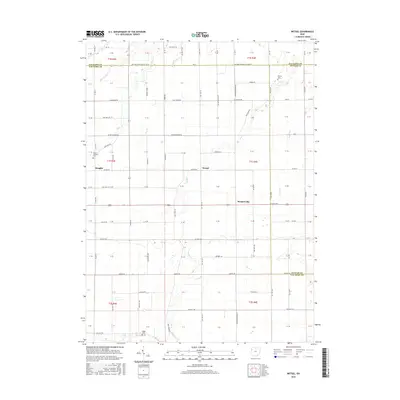
2016 Map of Wetsel
USGS Topo · Published 2016About this map
Hoaglin and Wetzel anchor this rural landscape where three Ohio counties—Van Wert, Paulding, and Putnam—meet. The terrain is defined by a dense grid of township and county roads, such as Van Wert-Paulding Co Line Rd and Elm Sugar Rd, reflecting the late-era agricultural layout of the region. Waterways like Big Run and Dog Cr cut across the geometric field patterns, while small clusters of settlement persist at Seamersville and Ridge. For local historians and genealogists, the map identifies specific burial grounds including Dotson Cem, Mount Pleasant Cem, and Ridge Cem, providing precise locations for ancestral research. The intersection of major thoroughfares like US Rte 224 and Co Hwy 185 illustrates the modern transportation network laid over the historic township sections of T1N and T1S.
Find a feature on this map
106 named features on this map. Tap any name to fly to it.
Don’t see what you’re looking for? This feature index may not catch every label — zoom into the map to look around manually.
Map Details
Editions of this 2016 Wetsel Map
This is the sole edition of this map. No revisions or reprints were ever made.
Other maps of this area

1909 · Continental
USGS Topo · 1:62,500

1911 · Delphos
USGS Topo · 1:62,500

1914 · Van Wert
USGS Topo · 1:62,500

1914 · Paulding
USGS Topo · 1:62,500

1944 · Delphos
USGS Topo · 1:62,500

1944 · Van Wert
USGS Topo · 1:62,500

1944 · Paulding
USGS Topo · 1:62,500

1953 · Fort Wayne
USGS Topo · 1:250,000

1953 · Muncie
USGS Topo · 1:250,000

1956 · Muncie
USGS Topo · 1:250,000