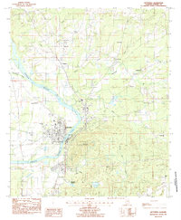
1987 Map of Wetumpka
USGS Topo · Published 1987About this map
Wetumpka serves as the focal point of this Elmore County study, situated along the winding banks of the Coosa River. The mid-1980s landscape reveals a mix of civic institutions and rural landmarks, from the established street grid containing the Grammar Sch and Vocational Center to the nearby Julia Tutwiler Prison. North of the main settlement, the community of Wallsboro and the heights of Bald Knob anchor a terrain defined by numerous watercourses, including Yellow Water Creek and Fourmile Creek. Genealogists will find significant local value in the distribution of rural congregations and burial sites such as Mt Canaan Ch, Thelma Ch, and the Batchler Cem. The area's recreational and memorial spaces are well-documented through Gold Star Mem Park and the Pine View Memorial Gardens, illustrating the community's growth and land use patterns as the century progressed.
Find a feature on this map
34 named features on this map. Tap any name to fly to it.
Don’t see what you’re looking for? This feature index may not catch every label — zoom into the map to look around manually.
Map Details
Editions of this 1987 Wetumpka Map
2 editions found
Other maps of this area

1901 · Wetumpka
USGS Topo · 1:125,000

1901 · Wetumpka
USGS Topo · 1:62,500

1903 · Wetumpka
USGS Topo · 1:125,000

1927 · Montgomery
USGS Topo · 1:48,000

1930 · Montgomery
USGS Topo · 1:62,500

1953 · Montgomery
USGS Topo · 1:250,000

1956 · Montgomery
USGS Topo · 1:250,000

1957 · Montgomery
USGS Topo · 1:250,000

1958 · Montgomery
USGS Topo · 1:62,500

1958 · Montgomery North
USGS Topo · 1:24,000