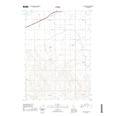
2020 Map of Wheatgrass Bench
USGS Topo · Published 2020About this map
Wheatgrass Bench rises above the Arbon Valley floor, defining a landscape shaped by a complex network of water management features in this modern Idaho survey. The northern edge of the map follows the periphery of the American Falls Reservoir, where the settlement of Bannock sits along the road and rail corridor. Moving south, the terrain transitions from the managed agricultural grids of the valley to the dissected uplands of Compressor Station Bench and the southern hills.
Find a feature on this map
37 named features on this map. Tap any name to fly to it.
Don’t see what you’re looking for? This feature index may not catch every label — zoom into the map to look around manually.
Map Details
Editions of this 2020 Wheatgrass Bench Map
This is the sole edition of this map. No revisions or reprints were ever made.
Other maps of this area

1934 · American Falls
USGS Topo · 1:62,500

1934 · Michaud
USGS Topo · 1:62,500

1934 · Rockland
USGS Topo · 1:62,500

1936 · American Falls
USGS Topo · 1:62,500

1937 · Rockland
USGS Topo · 1:62,500

1937 · Michaud
USGS Topo · 1:62,500

1938 · Pauline
USGS Topo · 1:48,000

1944 · Arbon
USGS Topo · 1:62,500

1954 · Pocatello
USGS Topo · 1:250,000

1958 · Pocatello
USGS Topo · 1:250,000