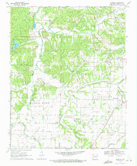
1970 Map of Wheeler
USGS Topo · Published 1972About this map
The Illinois River meanders through this portion of Washington County, marking a landscape defined by small valley settlements and the upland terrain of Marrs Hill. In the north, the Ozark National Forest borders Lake Weddington, while the eastern portion of the map shows the growth of Farmington and the smaller community of Wheeler. Evidence of earlier infrastructure is visible in the Old Railroad Grade cutting across the central hills, a key artifact for those tracing historical transportation corridors in Northwest Arkansas.
Find a feature on this map
32 named features on this map. Tap any name to fly to it.
Don’t see what you’re looking for? This feature index may not catch every label — zoom into the map to look around manually.
Map Details
Editions of this 1970 Wheeler Map
4 editions found
Other maps of this area

1898 · Winslow
USGS Topo · 1:125,000

1899 · Fayetteville
USGS Topo · 1:125,000

1901 · Winslow
USGS Topo · 1:125,000

1901 · Fayetteville
USGS Topo · 1:125,000

1904 · Fayetteville
USGS Topo · 1:125,000

1946 · Fort Smith
USGS Topo · 1:250,000

1954 · Tulsa
USGS Topo · 1:250,000

1958 · Fayetteville
USGS Topo · 1:24,000

1958 · Tulsa
USGS Topo · 1:250,000

1963 · Tulsa
USGS Topo · 1:250,000