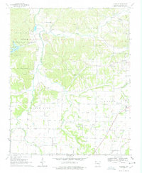
1970 Map of Wheeler
USGS Topo · Published 1978About this map
The Illinois River and its major tributaries, including Clear Creek and Goose Creek, define the landscape of this region west of Fayetteville. The rugged eastern edge of the Weddington Ozark National Forest borders the river, where the Lake Weddington area provides a distinct recreational and topographical contrast to the more open agricultural lands of Center and Prairie Grove townships. In the southeast, the town of Farmington is shown at a point of growth near the junction of Spring Creek and Farmington Branch.
Find a feature on this map
33 named features on this map. Tap any name to fly to it.
Don’t see what you’re looking for? This feature index may not catch every label — zoom into the map to look around manually.
Map Details
Editions of this 1970 Wheeler Map
4 editions found
Other maps of this area

1898 · Winslow
USGS Topo · 1:125,000

1899 · Fayetteville
USGS Topo · 1:125,000

1901 · Winslow
USGS Topo · 1:125,000

1901 · Fayetteville
USGS Topo · 1:125,000

1904 · Fayetteville
USGS Topo · 1:125,000

1946 · Fort Smith
USGS Topo · 1:250,000

1954 · Tulsa
USGS Topo · 1:250,000

1958 · Fayetteville
USGS Topo · 1:24,000

1958 · Tulsa
USGS Topo · 1:250,000

1963 · Tulsa
USGS Topo · 1:250,000