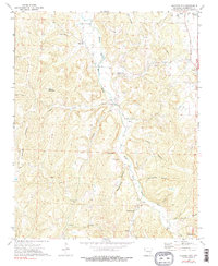
1973 Map of Sulphur City
USGS Topo · Published 1990About this map
The Middle Fork White River carves a deep valley through the Ozark landscape of Washington County, anchoring a series of small agricultural settlements and family landmarks. In the early 1970s, this area remained defined by its river-and-hollow topography, where communities like Sulphur City and Arnett grew along the primary watercourse. The map reveals a dense network of upland features, including Snyder Mountain and Lingebaugh Mountain, which separate the various drainage basins of Trace Creek and Parker Branch. Local history is preserved in numerous scattered burial grounds and spiritual centers, such as the Low Gap Ch & Cem and Zion Cem, alongside geological curiosities like Fincher Cave and Bassett Cave. These features suggest a long-standing pattern of dispersed mountain settlement, where life was organized around the narrow fertile strips of the hollows.
Find a feature on this map
37 named features on this map. Tap any name to fly to it.
Don’t see what you’re looking for? This feature index may not catch every label — zoom into the map to look around manually.
Map Details
Editions of this 1973 Sulphur City Map
3 editions found
Other maps of this area

1898 · Winslow
USGS Topo · 1:125,000

1899 · Fayetteville
USGS Topo · 1:125,000

1900 · Eureka Springs
USGS Topo · 1:125,000

1901 · Winslow
USGS Topo · 1:125,000

1901 · Eureka Springs
USGS Topo · 1:125,000

1901 · Fayetteville
USGS Topo · 1:125,000

1904 · Fayetteville
USGS Topo · 1:125,000

1943 · St. Paul
USGS Topo · 1:62,500

1945 · Harrison
USGS Topo · 1:250,000

1946 · St. Paul
USGS Topo · 1:62,500