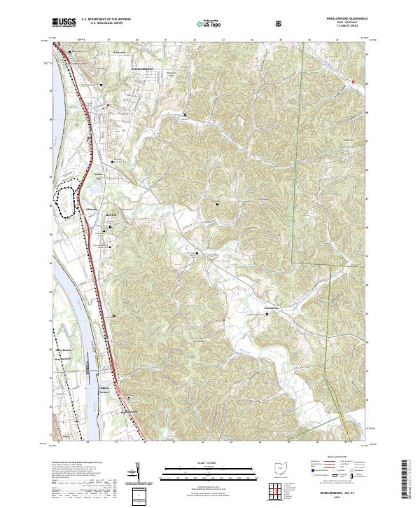
2023 Map of Wheelersburg
USGS Topo · Published 2023About this map
Wheelersburg and its surrounding communities are positioned along the eastern bank of the Ohio River, where the industrial and residential development of Scioto County meets the steep, wooded terrain of the Wayne National Forest. The map documents a complex landscape of narrow hollows and ridges, such as Dogwood Ridge and Germany Hollow, which have historically dictated the placement of roads and small settlements like Powellsville and Allentown.
Find a feature on this map
135 named features on this map. Tap any name to fly to it.
Don’t see what you’re looking for? This feature index may not catch every label — zoom into the map to look around manually.
Map Details
Editions of this 2023 Wheelersburg Map
This is the sole edition of this map. No revisions or reprints were ever made.
Other maps of this area

1898 · Ironton
USGS Topo · 1:62,500

1900 · Ironton
USGS Topo · 1:62,500

1911 · Sciotoville
USGS Topo · 1:62,500

1912 · Oak Hill
USGS Topo · 1:62,500

1913 · Sciotoville
USGS Topo · 1:62,500

1926 · Greenup
USGS Topo · 1:48,000

1930 · Greenup
USGS Topo · 1:62,500
1953 · Load
USGS Topo · 1:24,000

1953 · Greenup
USGS Topo · 1:24,000
1953 · Portsmouth
USGS Topo · 1:24,000