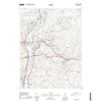
2019 Map of Wheeling
USGS Topo · Published 2019About this map
The Ohio River corridor and its industrial-transportation legacy dominate this map of the Northern Panhandle, where the river separates West Virginia from Ohio. Historically significant river crossings, including the iconic Wheeling Suspension Bridge and the Fort Henry Bridge, connect Wheeling and Wheeling Island to western neighbors like Bridgeport and Aetnaville. The topography is defined by the steep valleys of Wheeling Creek and its tributaries, such as Little Wheeling Creek and Middle Wheeling Creek, which served as the primary conduits for rail and road development.
Find a feature on this map
84 named features on this map. Tap any name to fly to it.
Don’t see what you’re looking for? This feature index may not catch every label — zoom into the map to look around manually.
Map Details
Editions of this 2019 Wheeling Map
This is the sole edition of this map. No revisions or reprints were ever made.
Other maps of this area

1902 · Wheeling
USGS Topo · 1:62,500

1904 · Cameron
USGS Topo · 1:62,500

1905 · Clarington
USGS Topo · 1:62,500

1905 · St. Clairsville
USGS Topo · 1:62,500

1935 · Cameron
USGS Topo · 1:62,500

1935 · Clarington
USGS Topo · 1:62,500

1935 · Wheeling
USGS Topo · 1:62,500

1940 · Clarington
USGS Topo · 1:62,500

1942 · Cameron
USGS Topo · 1:62,500

1942 · Wheeling
USGS Topo · 1:62,500