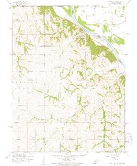
1959 Map of White Cloud
USGS Topo · Published 1960About this map
The White Cloud riverfront and its surrounding bluffs overlook the winding Missouri River in this late 1950s survey. The landscape is marked by the Old Indian Boundary, which bisects the rolling hills where the Iowa and Irving townships meet. This area, located at the complex junction of Kansas, Nebraska, and Missouri, shows a rural economy supported by intricate drainage systems like Squaw Creek and the CR Ditch, protected by a riverside Levee.
Find a feature on this map
27 named features on this map. Tap any name to fly to it.
Don’t see what you’re looking for? This feature index may not catch every label — zoom into the map to look around manually.
Map Details
Editions of this 1959 White Cloud Map
4 editions found
Other maps of this area

1885 · Atchison
USGS Topo · 1:125,000

1888 · Atchison
USGS Topo · 1:125,000

1893 · Atchison
USGS Topo · 1:125,000

1920 · Craig
USGS Topo · 1:62,500

1926 · Oregon
USGS Topo · 1:62,500

1926 · Maitland
USGS Topo · 1:62,500

1950 · Kansas City
USGS Topo · 1:250,000

1954 · Kansas City
USGS Topo · 1:250,000

1955 · Nebraska City
USGS Topo · 1:250,000

1956 · Kansas City
USGS Topo · 1:250,000