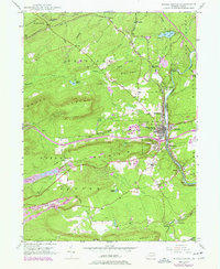
1947 Map of White Haven
USGS Topo · Published 1977About this map
The Lehigh River carves a deep valley through the mountains of Luzerne and Carbon counties, anchoring the regional economy around White Haven and East Side. By the mid-20th century, the landscape reflected a complex layering of transportation and industrial history, from the Conrail tracks following the river's bend to the newer Pennsylvania Turnpike Northeast Extension cutting across the highlands. Local life centers on established settlements like Port Jenkins, Middleburg, and Bridgeport, while the rural uplands are marked by the Ripple Sch, St Patrick Cem, and specialized facilities such as Jefferson Hospital. Evidence of the region's extractive roots is visible in the scattered Strip Mine operations near Pond Creek and Sandy Run, illustrating the shift from river-based transit to heavy mountain industry.
Find a feature on this map
61 named features on this map. Tap any name to fly to it.
Don’t see what you’re looking for? This feature index may not catch every label — zoom into the map to look around manually.
Map Details
Editions of this 1947 White Haven Map
4 editions found
Other maps of this area

1889 · Hazleton
USGS Topo · 1:62,500

1891 · Wilkesbarre
USGS Topo · 1:62,500

1891 · Hazleton
USGS Topo · 1:62,500

1893 · Hazleton
USGS Topo · 1:62,500

1894 · Wilkesbarre
USGS Topo · 1:62,500

1922 · Mauch Chunk
USGS Topo · 1:62,500

1922 · Stoddartsville
USGS Topo · 1:62,500

1924 · Stoddartsville
USGS Topo · 1:62,500

1924 · Mauch Chunk
USGS Topo · 1:62,500

1943 · Scranton
USGS Topo · 1:125,000