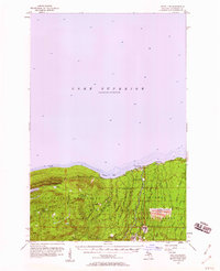
1956 Map of White Pine
USGS Topo · Published 1960About this map
The rugged shoreline of Lake Superior meets a landscape defined by industrial extraction and public wilderness in this mid-century survey of Ontonagon County. The southern shore of Union Bay serves as the gateway to the Porcupine Mountains State Park, where landmarks like Lake of the Clouds and Government Peak rise above the timber. The era's copper mining legacy is visible in the cluster of heritage sites including the Carp Lake Mine, Cuyahoga Mine, and the settlement at Nonesuch. To the east, the modern industrial footprint of the White Pine Mine dominates, complete with a massive Tailings Pond, a Smoke Stack, and an above ground pipeline servicing the facility near the village of White Pine. This map documents a period when the timber of the Ottawa National Forest and the minerals beneath it were being balanced against the burgeoning recreational use of the peaks and falls.
Find a feature on this map
48 named features on this map. Tap any name to fly to it.
Don’t see what you’re looking for? This feature index may not catch every label — zoom into the map to look around manually.
Map Details
Editions of this 1956 White Pine Map
3 editions found

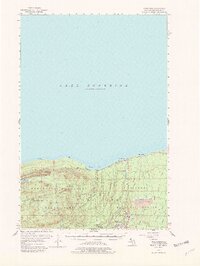
Other maps of this area

1949 · Matchwood NW
USGS Topo · 1:24,000

1949 · White Pine
USGS Topo · 1:24,000

1949 · Bergland NE
USGS Topo · 1:24,000

1955 · Ontonagon
USGS Topo · 1:62,500

1956 · Carp River
USGS Topo · 1:62,500

1956 · Bergland NE
USGS Topo · 1:24,000

1956 · Bergland
USGS Topo · 1:62,500

1956 · Thomaston
USGS Topo · 1:62,500

1956 · White Pine
USGS Topo · 1:24,000

1956 · Matchwood NW
USGS Topo · 1:24,000