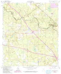
1961 Map of White Springs West
USGS Topo · Published 1993About this map
The Suwannee River snakes through the heart of this North Florida landscape, marking the winding boundaries between Hamilton, Suwannee, and Columbia Counties. At the eastern edge, the settlement of White Springs serves as a focal point, established around the White Sulphur Spring and the Stephen Foster State Memorial. This area preserves a mid-century view of the region's rural character, where small communities like Springville and Pouchers Corner are connected by a network of local routes including Old Miller Road and the Old Railroad Grade.
Find a feature on this map
52 named features on this map. Tap any name to fly to it.
Don’t see what you’re looking for? This feature index may not catch every label — zoom into the map to look around manually.
Map Details
Editions of this 1961 White Springs West Map
3 editions found
Other maps of this area

1954 · Valdosta
USGS Topo · 1:250,000

1958 · Valdosta
USGS Topo · 1:250,000

1959 · Valdosta
USGS Topo · 1:250,000

1961 · Live Oak East
USGS Topo · 1:24,000

1961 · Hillcoat
USGS Topo · 1:24,000

1961 · White Springs East
USGS Topo · 1:24,000

1961 · White Springs West
USGS Topo · 1:24,000

1962 · Genoa
USGS Topo · 1:24,000

1963 · Lake City West
USGS Topo · 1:24,000
1969 · Wellborn
USGS Topo · 1:24,000