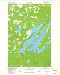
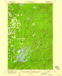
1981 Map of Whiteface Reservoir
USGS Topo · Published 1982About this map
Whiteface Reservoir dominates this northern landscape, its intricate shoreline and scattered islands reflecting the managed hydrography of the early 1980s. The map illustrates a region dedicated to public land use and recreation, where the Superior National Forest meets the Cloquet Valley State Forest. Small clusters of human activity are evident at the Community Hall and the Markham Cem, while the Cloquet Valley Lookout Tower stands as a sentinel for forest fire management in the south. The area is defined by its water systems, from the meandering Whiteface River to smaller glacial bodies like Markham Lake and Wiggle Lake. Seasonal access is emphasized through a network of specialized routes, including a Winter Trail and a Snowmobile Trail, highlighting the area's year-round recreational importance in St. Louis County.
Find a feature on this map
26 named features on this map. Tap any name to fly to it.
Don’t see what you’re looking for? This feature index may not catch every label — zoom into the map to look around manually.
Map Details
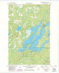
Editions of this 1981 Whiteface Reservoir Map
2 editions found
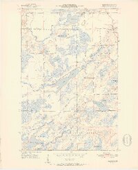
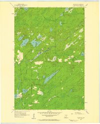
Other maps of this area

1951 · Palo
USGS Topo · 1:24,000
1951 · Makinen
USGS Topo · 1:24,000

1954 · Hibbing
USGS Topo · 1:250,000
1956 · Whiteface
USGS Topo · 1:24,000

1957 · Hibbing
USGS Topo · 1:250,000
1957 · Markham
USGS Topo · 1:62,500
1957 · Comstock Lake
USGS Topo · 1:24,000
1957 · Boulder Lake Reservoir NE
USGS Topo · 1:24,000

1958 · Hibbing
USGS Topo · 1:250,000

1964 · Hibbing
USGS Topo · 1:250,000