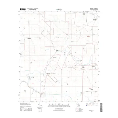
2015 Map of Whitehall
USGS Topo · Published 2015About this map
Whitehall and Maurepas serve as central points in this Louisiana landscape, where the Amite River winds through a complex system of islands and bayous. The settlement pattern is defined by river access, with numerous landings such as Tiger Bluff Landing, Catfish Landing, and Union Landing marking the banks of the Amite and Tickfaw River. This network of waterways and low-lying land includes distinctive features like Ficklin Island and Steam Island, reflecting the river-based commerce and transportation that has historically shaped Livingston Parish.
Find a feature on this map
92 named features on this map. Tap any name to fly to it.
Don’t see what you’re looking for? This feature index may not catch every label — zoom into the map to look around manually.
Map Details
Editions of this 2015 Whitehall Map
This is the sole edition of this map. No revisions or reprints were ever made.
Other maps of this area

1892 · Mount Airy
USGS Topo · 1:62,500

1892 · Donaldsonville
USGS Topo · 1:62,500

1934 · Denham Springs
USGS Topo · 1:62,500

1934 · Springfield
USGS Topo · 1:62,500

1939 · Springfield
USGS Topo · 1:62,500

1939 · Denham Springs
USGS Topo · 1:62,500

1939 · Donaldsonville
USGS Topo · 1:62,500

1946 · North of Garyville
USGS Topo · 1:31,680

1946 · Petite Amite River
USGS Topo · 1:31,680

1947 · Sorrento
USGS Topo · 1:31,680