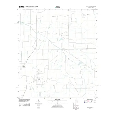
2010 Map of Whites Bayou
USGS Topo · Published 2010About this map
Abshier Settlement and the small community of Cottonwood anchor this landscape of the Texas coastal plain, where the natural hydrology of Whites Bayou and Crooked Bayou is intersected by a complex system of irrigation and drainage infrastructure. The presence of the West Branch Devers Canal and various unnamed ditches highlights the importance of water management for agricultural operations in Liberty County. Local industry is clearly defined by the Hankamer Oil Field, situated near the winding course of the bayous and the marshlands. Family and community history is preserved across several burial grounds, including the Sahara Cemetery, Freeman Cemetery, and Abshier Cemetery, which are scattered among the fields and low-lying areas. The road network, featuring FM 1410 and Hankamer Loop Rd, connects these rural clusters through the expansive Crooked Marsh.
Find a feature on this map
25 named features on this map. Tap any name to fly to it.
Don’t see what you’re looking for? This feature index may not catch every label — zoom into the map to look around manually.
Map Details
Editions of this 2010 Whites Bayou Map
This is the sole edition of this map. No revisions or reprints were ever made.
Other maps of this area

1942 · Anahuac
USGS Topo · 1:24,000

1943 · Whites Bayou
USGS Topo · 1:24,000

1943 · Liberty
USGS Topo · 1:125,000

1943 · Stowell
USGS Topo · 1:24,000

1945 · Nolte
USGS Topo · 1:31,680

1950 · Houston
USGS Topo · 1:250,000

1954 · Beaumont
USGS Topo · 1:250,000

1955 · Daisetta
USGS Topo · 1:62,500

1955 · Sour Lake
USGS Topo · 1:62,500

1956 · Houston
USGS Topo · 1:250,000