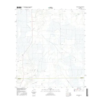
2016 Map of Whites Bayou
USGS Topo · Published 2016About this map
Whites Bayou meanders through a low-lying coastal landscape where Liberty and Chambers counties meet, defining a region shaped by complex water management and rural settlement. The terrain is marked by an extensive network of irrigation and drainage infrastructure, including the West Branch Devers Canal, E Br Devers Canal, and Ogden Ditch, which support the surrounding agricultural lands. For those researching local family history, the map identifies small, isolated burial grounds such as Abshier Cem and Freeman Cem, often the only remaining markers of early pioneer homesteads in this marshy environment. The eastern portion of the quadrangle is dominated by the sprawling wetlands of Crooked Marsh and Willis Marsh, while the tidal influence is evident in features like Lee Cove and the reaching fingers of E Fork Double Bayou. This 2016 survey illustrates the persistent interface between man-made waterways and the natural bayou systems of the Texas Gulf Coast.
Find a feature on this map
42 named features on this map. Tap any name to fly to it.
Don’t see what you’re looking for? This feature index may not catch every label — zoom into the map to look around manually.
Map Details
Editions of this 2016 Whites Bayou Map
This is the sole edition of this map. No revisions or reprints were ever made.
Other maps of this area

1942 · Anahuac
USGS Topo · 1:24,000

1943 · Whites Bayou
USGS Topo · 1:24,000

1943 · Liberty
USGS Topo · 1:125,000

1943 · Stowell
USGS Topo · 1:24,000

1945 · Nolte
USGS Topo · 1:31,680

1950 · Houston
USGS Topo · 1:250,000

1954 · Beaumont
USGS Topo · 1:250,000

1955 · Daisetta
USGS Topo · 1:62,500

1955 · Sour Lake
USGS Topo · 1:62,500

1956 · Houston
USGS Topo · 1:250,000