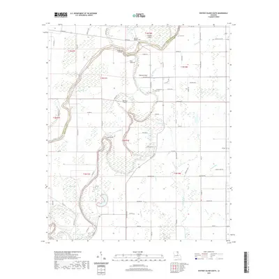
2020 Map of Whitney Island South
USGS Topo · Published 2020About this map
Bayou Lafourche and the Boeuf River wind through the alluvial landscape along the Morehouse Parish and Richland Parish border. This modern survey illustrates a complex hydrological environment shaped by human intervention and natural flow, featuring engineered improvements like the Lafourche Cut-off and Cut-Off Number Two. These diversions have created distinct landforms such as Whitney Island, Hegwood Island, and Old River Island, while the surrounding terrain is marked by wetlands including Balfour Brake and Mercer Brake. While the settlement at Point Jefferson remains a focal point, the map is a valuable resource for genealogists tracing local family plots, with clearly marked locations for Shanks Cem, Stevenson Cem, Trio Cem, and McKnight Cem scattered across the low-lying basin.
Find a feature on this map
80 named features on this map. Tap any name to fly to it.
Don’t see what you’re looking for? This feature index may not catch every label — zoom into the map to look around manually.
Map Details
Editions of this 2020 Whitney Island South Map
This is the sole edition of this map. No revisions or reprints were ever made.
Other maps of this area

1935 · Collinston
USGS Topo · 1:62,500

1935 · Alto
USGS Topo · 1:62,500

1935 · Baskinton
USGS Topo · 1:62,500

1935 · Hurricane
USGS Topo · 1:62,500

1955 · Jackson
USGS Topo · 1:250,000

1957 · Mangham
USGS Topo · 1:62,500

1957 · Collinston
USGS Topo · 1:62,500

1958 · Baskinton
USGS Topo · 1:62,500

1958 · Hurricane
USGS Topo · 1:62,500

1961 · Jackson
USGS Topo · 1:250,000