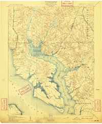
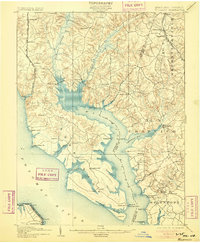
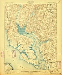
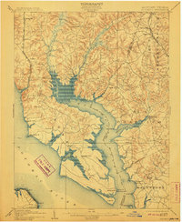
1902 Map of Wicomico
USGS Topo · Published 1909About this map
The Wicomico River and its convoluted shoreline dominate this early twentieth-century survey, revealing a landscape defined by tidewater commerce and sprawling wetlands. The Philadelphia Wilmington and Baltimore R. R. and the Southern Maryland R. R. provide critical inland connections, but the life of the region clearly centers on the water. A network of maritime infrastructure including Plowdens Wharf, Lancaster Wharf, and Wilkerson Wharf illustrates the reliance on river transport for agricultural goods.
Find a feature on this map
69 named features on this map. Tap any name to fly to it.
Don’t see what you’re looking for? This feature index may not catch every label — zoom into the map to look around manually.
Map Details
Editions of this 1902 Wicomico Map
5 editions found

Other maps of this area

1889 · Fredericksburg
USGS Topo · 1:125,000

1890 · Mt. Vernon
USGS Topo · 1:125,000

1891 · Mt. Vernon
USGS Topo · 1:125,000

1892 · Leonardtown
USGS Topo · 1:62,500

1892 · Fredericksburg
USGS Topo · 1:125,000

1892 · Prince Frederick
USGS Topo · 1:62,500

1892 · Brandywine
USGS Topo · 1:62,500

1892 · Piney Point
USGS Topo · 1:62,500

1892 · Montross
USGS Topo · 1:62,500

1894 · Wicomico
USGS Topo · 1:62,500