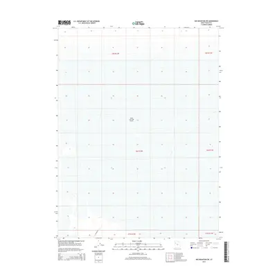
2014 Map of Wig Mountain SW
USGS Topo · Published 2014About this map
The Great Salt Lake Desert dominates this 2014 survey of the Wig Mountain SW quadrangle, illustrating the stark, expansive landscape of Utah's West Desert. The map reveals the intricate township and range grid system typical of the American West, including boundaries for t6s r12w, t6s r11w, and t5s r12w. Infrastructure in this arid environment is minimal, centered largely on the presence of Falconer Rd in the southwestern corner. The map provides a precise record of the desert floor's elevation and topography as it existed in the early 21st century, offering a baseline for environmental researchers and those studying the geographical layout of Tooele County's more isolated regions.
Find a feature on this map
8 named features on this map. Tap any name to fly to it.
Don’t see what you’re looking for? This feature index may not catch every label — zoom into the map to look around manually.
Map Details
Editions of this 2014 Wig Mountain SW Map
This is the sole edition of this map. No revisions or reprints were ever made.
Other maps of this area

1953 · Tooele
USGS Topo · 1:250,000

1954 · Wig Mtn SW
USGS Topo · 1:24,000

1954 · Dugway Proving Ground NE
USGS Topo · 1:24,000

1954 · Wildcat Mtn
USGS Topo · 1:24,000

1954 · Granite Peak
USGS Topo · 1:24,000

1954 · Wildcat Mtn SE
USGS Topo · 1:24,000

1954 · Dugway Proving Ground NW
USGS Topo · 1:24,000

1954 · Wig Mtn NW
USGS Topo · 1:24,000

1955 · Wig Mtn
USGS Topo · 1:24,000

1955 · Wig Mtn NE
USGS Topo · 1:24,000