1955 Map of Wig Mtn
USGS Topo · Published 1974About this map
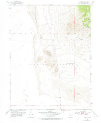
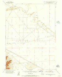
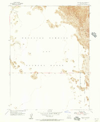
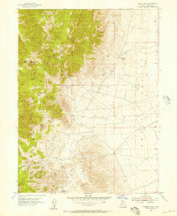
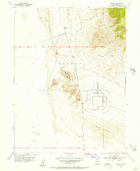
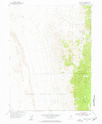
Dugway Proving Ground dominates this 1955 landscape, occupying a desolate stretch of the Utah desert defined by shifting Sand Dunes and the isolated rise of Wig Mountain. The eastern edge of the quadrangle is anchored by the Cedar Mountains, where a single Jeep Trail winds through the high terrain, marking one of the few signs of human transit in this restricted military zone. The map illustrates the specialized infrastructure of the proving ground, featuring a geometric network of roads and enclosures set against the expansive, arid flats. This survey provides a precise record of mid-century military land use and topographic isolation in Tooele County during the Cold War era.
Find a feature on this map
8 named features on this map. Tap any name to fly to it.
Don’t see what you’re looking for? This feature index may not catch every label — zoom into the map to look around manually.
Map Details
Editions of this 1955 Wig Mtn Map
3 editions found

Other maps of this area

1885 · Tooele Valley
USGS Topo · 1:250,000

1953 · Tooele
USGS Topo · 1:250,000
1954 · Wig Mtn SW
USGS Topo · 1:24,000
1954 · Dugway Proving Ground NE
USGS Topo · 1:24,000
1954 · Camels Back Ridge NW
USGS Topo · 1:24,000
1954 · Dugway Proving Ground NW
USGS Topo · 1:24,000
1954 · Wig Mtn NW
USGS Topo · 1:24,000
1955 · Tabbys Peak
USGS Topo · 1:24,000
1955 · Wig Mtn
USGS Topo · 1:24,000
1955 · Wig Mtn NE
USGS Topo · 1:24,000