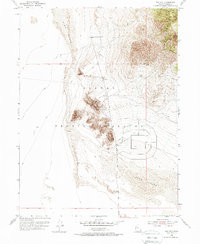
1955 Map of Wig Mtn
USGS Topo · Published 1988About this map
Wig Mountain rises as a prominent high point above the desert floor within the restricted boundaries of the Dugway Proving Ground in Tooele County. This 1955 survey illustrates a landscape defined by dramatic shifting Sand Dunes that press against the western slopes of the Cedar Mountains. The map reveals a specialized military and desert environment where transit is limited to a handful of paths like the North Wig Mtn Road and various rugged Jeep Trails. The complex contour work and large geometric grid patterns east of the mountain indicate early Cold War era installations or testing areas within the proving grounds. This topography is essential for understanding the mid-century expansion of military testing sites in the Great Salt Lake Desert, capturing the intersection of isolated natural terrain and national defense infrastructure.
Find a feature on this map
9 named features on this map. Tap any name to fly to it.
Don’t see what you’re looking for? This feature index may not catch every label — zoom into the map to look around manually.
Map Details
Editions of this 1955 Wig Mtn Map
3 editions found
Other maps of this area

1885 · Tooele Valley
USGS Topo · 1:250,000

1953 · Tooele
USGS Topo · 1:250,000

1954 · Wig Mtn SW
USGS Topo · 1:24,000

1954 · Dugway Proving Ground NE
USGS Topo · 1:24,000

1954 · Camels Back Ridge NW
USGS Topo · 1:24,000

1954 · Dugway Proving Ground NW
USGS Topo · 1:24,000

1954 · Wig Mtn NW
USGS Topo · 1:24,000

1955 · Tabbys Peak
USGS Topo · 1:24,000

1955 · Wig Mtn
USGS Topo · 1:24,000

1955 · Wig Mtn NE
USGS Topo · 1:24,000