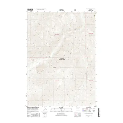
2015 Map of Wiggins Peak
USGS Topo · Published 2015About this map
Wiggins Peak and the high ridges of the Absaroka Range dominate this 2015 survey of the Shoshone National Forest in Wyoming. This high-altitude landscape is defined by its deep drainages and vertical relief, where several major tributaries converge. Wiggins Fork flows through the northwest, while the southeastern slopes are dissected by Bear Cr and Blue Cr. The presence of Black Canyon and Brown Rock Canyon highlights the dramatic erosional patterns typical of the eastern Absarokas, providing a clear picture of the hydrological network that feeds the region's larger river systems.
Find a feature on this map
17 named features on this map. Tap any name to fly to it.
Don’t see what you’re looking for? This feature index may not catch every label — zoom into the map to look around manually.
Map Details
Editions of this 2015 Wiggins Peak Map
This is the sole edition of this map. No revisions or reprints were ever made.
Other maps of this area

1904 · Kirwin
USGS Topo · 1:125,000

1905 · Younts Peak
USGS Topo · 1:125,000

1906 · Kirwin
USGS Topo · 1:125,000

1907 · Younts Peak
USGS Topo · 1:125,000

1955 · Thermopolis
USGS Topo · 1:250,000

1956 · Indian Point
USGS Topo · 1:24,000

1956 · Snow Lake
USGS Topo · 1:24,000

1956 · Emerald Lake
USGS Topo · 1:24,000

1958 · Thermopolis
USGS Topo · 1:250,000

1962 · Thermopolis
USGS Topo · 1:250,000