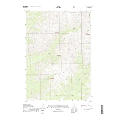
2017 Map of Wiggins Peak
USGS Topo · Published 2017About this map
Shoshone National Forest defines this high-elevation landscape in the Absaroka Range of Fremont County. Centered on the prominence of Wiggins Peak, the topography is carved by a network of drainage systems including Wiggins Fork, Caldwell Cr, and Bug Creek. A significant system of primitive pathways provides the only overland access through the complex terrain, notably the Absaroka Trail and the Wiggins Fork Trail, which track the watercourses and ridgelines. Geologic features like Black Canyon and Brown Rock Canyon reveal the deep erosion of the volcanic plateau. Toward the southern edge of the sheet, Mt Kent rises near the intersection of the Bear Creek Trail and Tepee Creek Trail, illustrating the remote character of this protected wilderness where transport remains limited to foot and pack animal routes.
Find a feature on this map
23 named features on this map. Tap any name to fly to it.
Don’t see what you’re looking for? This feature index may not catch every label — zoom into the map to look around manually.
Map Details
Editions of this 2017 Wiggins Peak Map
This is the sole edition of this map. No revisions or reprints were ever made.
Other maps of this area

1904 · Kirwin
USGS Topo · 1:125,000

1905 · Younts Peak
USGS Topo · 1:125,000

1906 · Kirwin
USGS Topo · 1:125,000

1907 · Younts Peak
USGS Topo · 1:125,000

1955 · Thermopolis
USGS Topo · 1:250,000

1956 · Indian Point
USGS Topo · 1:24,000

1956 · Snow Lake
USGS Topo · 1:24,000

1956 · Emerald Lake
USGS Topo · 1:24,000

1958 · Thermopolis
USGS Topo · 1:250,000

1962 · Thermopolis
USGS Topo · 1:250,000