
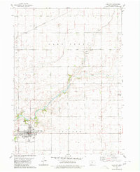
1980 Map of Wightman
USGS Topo · Published 1980About this map
The agricultural landscape of central Iowa is defined here by the winding course of Cedar Creek, which carves a wooded corridor through the productive farmlands of Calhoun and Greene Counties. This 1980 edition captures the intersection of two major rail lines, the Chicago and North Western and the Chicago Milwaukee St Paul and Pacific, which historically anchored the village of Wightman. The map provides a detailed view of local landmarks such as St Patricks Ch and Evergreen Cem, while showing the drainage patterns managed by Ditch No 121 and Ditch No 123. The northern section includes the University 40 County Park, offering a rare pocket of public land amidst the grid-patterned sections of Union and Reading townships.
Find a feature on this map
18 named features on this map. Tap any name to fly to it.
Don’t see what you’re looking for? This feature index may not catch every label — zoom into the map to look around manually.
Map Details
Editions of this 1980 Wightman Map
This is the sole edition of this map. No revisions or reprints were ever made.
Other maps of this area

1954 · Fort Dodge
USGS Topo · 1:250,000

1957 · Fort Dodge
USGS Topo · 1:250,000

1958 · Fort Dodge
USGS Topo · 1:250,000

1962 · Jefferson
USGS Topo · 1:62,500

1965 · Farnhamville
USGS Topo · 1:24,000
1980 · Glidden
USGS Topo · 1:24,000
1980 · Scranton
USGS Topo · 1:24,000
1980 · Lanesboro
USGS Topo · 1:24,000
1980 · Lohrville
USGS Topo · 1:24,000
1980 · Lake City
USGS Topo · 1:24,000