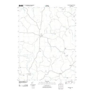
2010 Map of Wilkesville
USGS Topo · Published 2010About this map
Wilkesville and its surrounding hamlets in Vinton and Gallia Counties appear here alongside a network of tributary runs and cemeteries that define this rural Ohio landscape. The map highlights numerous burial grounds, including the Wilkesville Cemetery, Salem Center Cemetery, and the Point Pleasant Cemetery, which serve as vital landmarks for genealogical research. The local economy and social structure are anchored by small settlements like Salem Center, Danville, and Ewington, the latter featuring a dedicated Ewington Post Office.
Find a feature on this map
79 named features on this map. Tap any name to fly to it.
Don’t see what you’re looking for? This feature index may not catch every label — zoom into the map to look around manually.
Map Details
Editions of this 2010 Wilkesville Map
This is the sole edition of this map. No revisions or reprints were ever made.
Other maps of this area

1905 · Wilkesville
USGS Topo · 1:62,500

1906 · Bidwell
USGS Topo · 1:62,500

1907 · Pomeroy
USGS Topo · 1:62,500

1908 · Bidwell
USGS Topo · 1:62,500

1908 · Point Pleasant
USGS Topo · 1:62,500

1908 · Wilkesville
USGS Topo · 1:62,500

1926 · Point Pleasant
USGS Topo · 1:62,500

1929 · Point Pleasant
USGS Topo · 1:62,500

1947 · Columbus
USGS Topo · 1:250,000

1957 · Huntington
USGS Topo · 1:250,000