
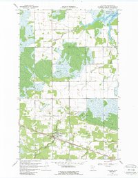
1967 Map of Williams
USGS Topo · Published 1969About this map
Williams serves as the central hub of this northern Minnesota landscape, situated along the Canadian National rail line. The settlement is anchored by local landmarks including Pine Hill Cem and a nearby Roadside Park. To the north, the terrain transitions into the protected wetlands and woods of Zippel Bay State Park, where the waters of Zippel Bay meet the shoreline of Lake of the Woods.
Find a feature on this map
14 named features on this map. Tap any name to fly to it.
Don’t see what you’re looking for? This feature index may not catch every label — zoom into the map to look around manually.
Map Details
Editions of this 1967 Williams Map
2 editions found
Other maps of this area

1918 · Winterroad
USGS Topo · 1:62,500

1918 · Roosevelt
USGS Topo · 1:62,500

1918 · Williams
USGS Topo · 1:62,500

1919 · Peppermint Creek
USGS Topo · 1:62,500

1943 · Peppermint Creek
USGS Topo · 1:62,500

1943 · Roosevelt
USGS Topo · 1:62,500

1954 · Roseau
USGS Topo · 1:250,000

1957 · Roseau
USGS Topo · 1:250,000

1958 · Roseau
USGS Topo · 1:250,000
1967 · Roosevelt
USGS Topo · 1:24,000