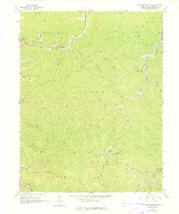
1965 Map of Williams Mountain
USGS Topo · Published 1975About this map
The rugged coal-country terrain of Boone County is captured here during a period of active surface mining and industrial development. Small settlements like Andrew and Prenter are linked by the Chesapeake and Ohio railroad line, which follows the winding valley of Hopkins Fork. The map documents a deeply vertical landscape where family history is etched into the hillsides at the Harless Cem, Bias Cem, and Jarrells Cem.
Find a feature on this map
60 named features on this map. Tap any name to fly to it.
Don’t see what you’re looking for? This feature index may not catch every label — zoom into the map to look around manually.
Map Details
Editions of this 1965 Williams Mountain Map
3 editions found
Other maps of this area

1891 · Oceana
USGS Topo · 1:125,000

1893 · Oceana
USGS Topo · 1:125,000

1898 · Oceana
USGS Topo · 1:125,000

1899 · Charleston
USGS Topo · 1:125,000

1909 · Peytona
USGS Topo · 1:48,000

1910 · Bald Knob
USGS Topo · 1:48,000

1911 · Peytona
USGS Topo · 1:62,500

1911 · Madison
USGS Topo · 1:62,500

1912 · Bald Knob
USGS Topo · 1:62,500

1913 · Logan
USGS Topo · 1:62,500