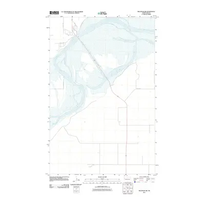
2011 Map of Williston SW
USGS Topo · Published 2011About this map
The Missouri River dominates this portion of Williams County, carving a wide, complex channel through the North Dakota landscape. This 2011 survey documents a river system characterized by shifting sandbars and expansive wetlands, illustrating the dynamic hydrology south of the Williston area. The western bank is defined by a network of local rural roads, including 141st Ave NW and 47th Ln NW, providing access to the high ground above the river bottom. To the north, a small cluster of residential development appears near Broken Horn Trl and Horizon Dr, signaling the gradual expansion of local homesteads toward the river's edge. This map serves as a vital record of the Missouri’s course and the sparse but vital transport network, like County Rd 4, that connects these riverine communities.
Find a feature on this map
8 named features on this map. Tap any name to fly to it.
Don’t see what you’re looking for? This feature index may not catch every label — zoom into the map to look around manually.
Map Details
Editions of this 2011 Williston SW Map
This is the sole edition of this map. No revisions or reprints were ever made.
Other maps of this area

1953 · Williston
USGS Topo · 1:250,000

1953 · Watford City
USGS Topo · 1:250,000

1957 · Williston
USGS Topo · 1:250,000

1957 · Watford City
USGS Topo · 1:250,000

1959 · Williston West
USGS Topo · 1:24,000

1959 · Williston East
USGS Topo · 1:24,000

1967 · Watford City
USGS Topo · 1:250,000

1969 · Trenton
USGS Topo · 1:24,000

1969 · Cartwright NE
USGS Topo · 1:24,000

1974 · Trenton NE
USGS Topo · 1:24,000