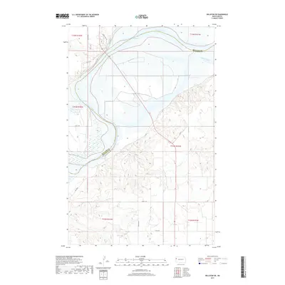
2017 Map of Williston SW
USGS Topo · Published 2017About this map
The Missouri River winds through the northern portion of this map, marking the significant boundary between Williams Co and McKenzie Co. This reach of the river transitions into the expansive waters of Lake Sakakawea, a landscape-altering reservoir that dominates the upper sections of the survey. The terrain is defined by the contrast between the flat river bottoms and the complex network of draws and coulees rising from the water's edge. A rural road network, including the aptly named Broken Horn Trl and Co Rd 4, provides access to these remote stretches of western North Dakota. The map meticulously documents the section lines of several townships, including t153n r101w and t152n r102w, which illustrate the enduring influence of the Public Land Survey System on the development of this prairie region south of Williston.
Find a feature on this map
19 named features on this map. Tap any name to fly to it.
Don’t see what you’re looking for? This feature index may not catch every label — zoom into the map to look around manually.
Map Details
Editions of this 2017 Williston SW Map
This is the sole edition of this map. No revisions or reprints were ever made.
Other maps of this area

1953 · Williston
USGS Topo · 1:250,000

1953 · Watford City
USGS Topo · 1:250,000

1957 · Williston
USGS Topo · 1:250,000

1957 · Watford City
USGS Topo · 1:250,000

1959 · Williston West
USGS Topo · 1:24,000

1959 · Williston East
USGS Topo · 1:24,000

1967 · Watford City
USGS Topo · 1:250,000

1969 · Trenton
USGS Topo · 1:24,000

1969 · Cartwright NE
USGS Topo · 1:24,000

1974 · Trenton NE
USGS Topo · 1:24,000