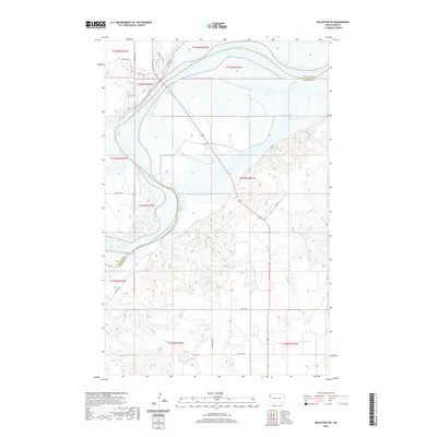
2020 Map of Williston SW
USGS Topo · Published 2020About this map
The Missouri River floodplain and its dramatic northern bluffs define this landscape where Williams County and McKenzie County meet. This survey shows the transition from the high, dissected plateaus of the Missouri Escarpment down to the wide, marshy bottomlands. The upland areas are marked by a modern residential and agricultural grid, with local access provided by routes like Basin Loop, Knoll Ave, and Southview Ave.
Find a feature on this map
20 named features on this map. Tap any name to fly to it.
Don’t see what you’re looking for? This feature index may not catch every label — zoom into the map to look around manually.
Map Details
Editions of this 2020 Williston SW Map
This is the sole edition of this map. No revisions or reprints were ever made.
Other maps of this area

1953 · Williston
USGS Topo · 1:250,000

1953 · Watford City
USGS Topo · 1:250,000

1957 · Williston
USGS Topo · 1:250,000

1957 · Watford City
USGS Topo · 1:250,000

1959 · Williston West
USGS Topo · 1:24,000

1959 · Williston East
USGS Topo · 1:24,000

1967 · Watford City
USGS Topo · 1:250,000

1969 · Trenton
USGS Topo · 1:24,000

1969 · Cartwright NE
USGS Topo · 1:24,000

1974 · Trenton NE
USGS Topo · 1:24,000