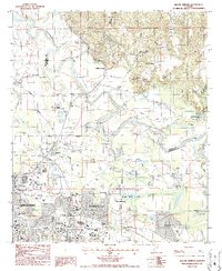
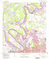
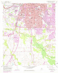
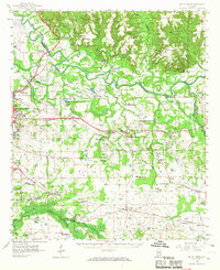
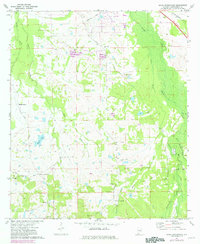
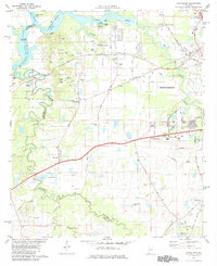
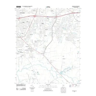
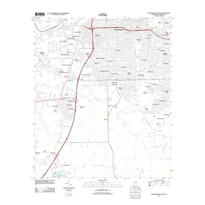
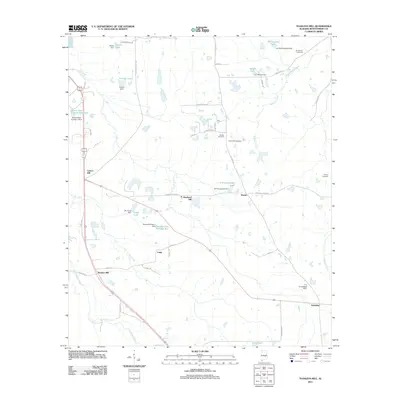
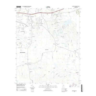
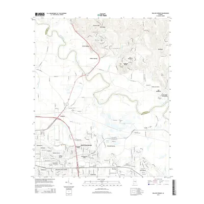
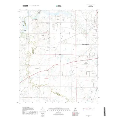
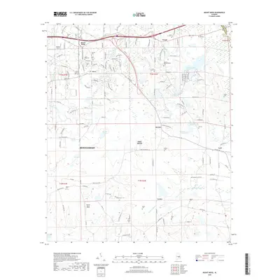
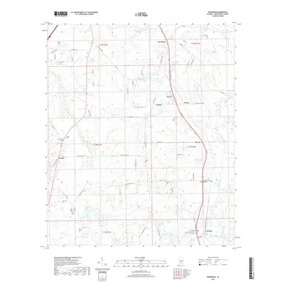
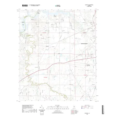
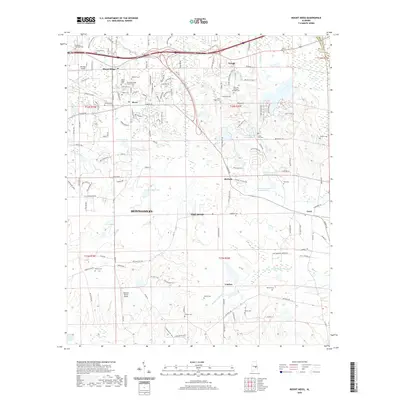
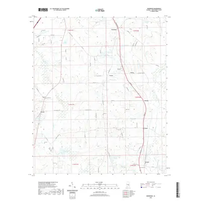
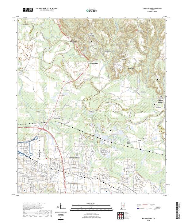
1987 Map of Willow Springs
USGS Topo · Published 1987About this map
The Tallapoosa River winds through this landscape on the northeastern edge of Alabama's capital, defining the border between Montgomery and Elmore counties. In the late 1980s, the area reflects a mix of military presence and suburban expansion, anchored by the Gunter AF Station and the Gunter Industrial Park in the southwest. The expansion of Montgomery East is evident through developments like Arrowhead and Mitylene, which sit alongside established institutions such as Alabama Christian College.
Find a feature on this map
52 named features on this map. Tap any name to fly to it.
Don’t see what you’re looking for? This feature index may not catch every label — zoom into the map to look around manually.
Map Details
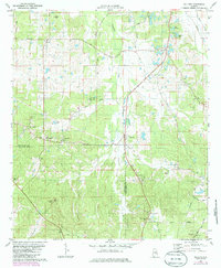
Editions of this 1987 Willow Springs Map
2 editions found
Historical Maps of Montgomery Through Time
80 maps found

1957 Letohatchee
Montgomery County, AL
1958 Montgomery North
Montgomery County, AL
1958 Montgomery South
Montgomery County, AL
1958 Mount Meigs
Montgomery County, AL
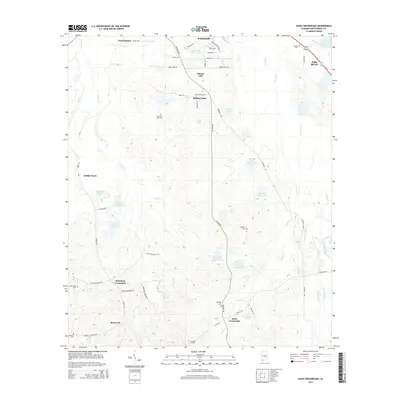
1971 Davis Crossroads
Montgomery County, AL
1971 Pine Level
Montgomery County, AL
1971 Ramer
Montgomery County, AL
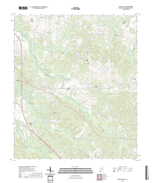
1971 Teasleys Mill
Montgomery County, AL

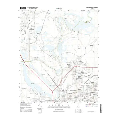
1975 Montgomery North
Montgomery County, AL

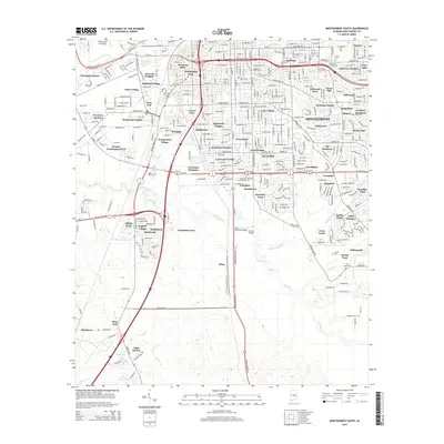
1975 Montgomery South
Montgomery County, AL

1975 Montgomery SW
Montgomery County, AL

1975 Mount Meigs NW
Montgomery County, AL

1975 Mount Meigs SE
Montgomery County, AL

1975 Mount Meigs SW
Montgomery County, AL
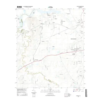
1981 Cantelous
Montgomery County, AL
1981 Sellers
Montgomery County, AL
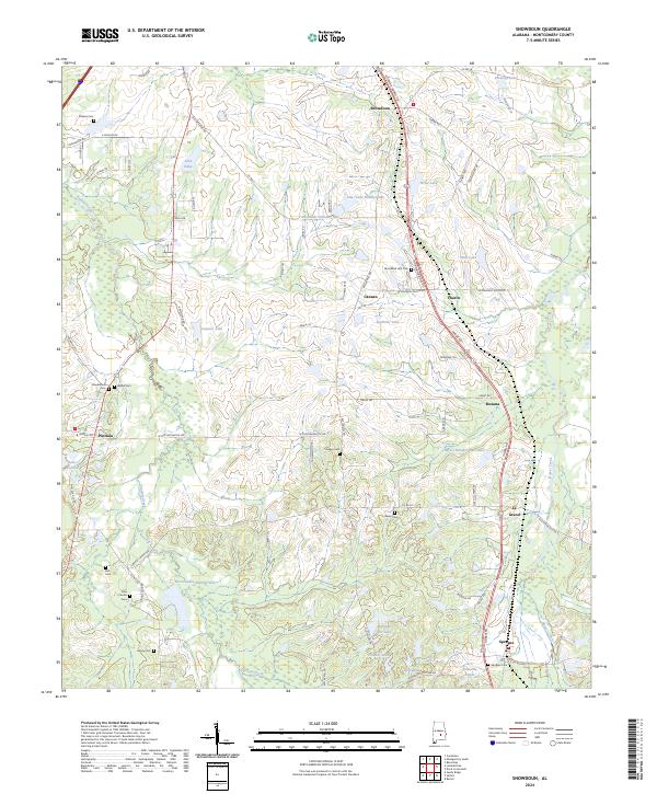
1981 Snowdoun
Montgomery County, AL

1987 Barachias
Montgomery County, AL

1987 Mount Meigs
Montgomery County, AL
1987 Willow Springs
Montgomery County, AL
2011 Barachias
Montgomery County, AL
2011 Cantelous
Montgomery County, AL
2011 Davis Crossroads
Montgomery County, AL
2011 Montgomery North
Montgomery County, AL
2011 Montgomery South
Montgomery County, AL
2011 Pine Level
Montgomery County, AL

2011 Ramer
Montgomery County, AL
2011 Sellers
Montgomery County, AL
2011 Snowdoun
Montgomery County, AL
2011 Teasleys Mill
Montgomery County, AL
2011 Willow Springs
Montgomery County, AL
2012 Mount Meigs
Montgomery County, AL
2014 Barachias
Montgomery County, AL
2014 Cantelous
Montgomery County, AL
2014 Davis Crossroads
Montgomery County, AL
2014 Montgomery North
Montgomery County, AL
2014 Montgomery South
Montgomery County, AL
2014 Mount Meigs
Montgomery County, AL
2014 Pine Level
Montgomery County, AL
2014 Ramer
Montgomery County, AL
2014 Sellers
Montgomery County, AL
2014 Snowdoun
Montgomery County, AL
2014 Teasleys Mill
Montgomery County, AL
2014 Willow Springs
Montgomery County, AL
2018 Barachias
Montgomery County, AL
2018 Cantelous
Montgomery County, AL
2018 Davis Crossroads
Montgomery County, AL
2018 Montgomery North
Montgomery County, AL
2018 Montgomery South
Montgomery County, AL
2018 Mount Meigs
Montgomery County, AL
2018 Pine Level
Montgomery County, AL
2018 Ramer
Montgomery County, AL
2018 Sellers
Montgomery County, AL
2018 Snowdoun
Montgomery County, AL
2018 Teasleys Mill
Montgomery County, AL
2018 Willow Springs
Montgomery County, AL
2020 Barachias
Montgomery County, AL
2020 Cantelous
Montgomery County, AL
2020 Davis Crossroads
Montgomery County, AL
2020 Montgomery North
Montgomery County, AL
2020 Montgomery South
Montgomery County, AL
2020 Mount Meigs
Montgomery County, AL
2020 Pine Level
Montgomery County, AL
2020 Ramer
Montgomery County, AL
2020 Sellers
Montgomery County, AL
2020 Snowdoun
Montgomery County, AL
2020 Teasleys Mill
Montgomery County, AL
2020 Willow Springs
Montgomery County, AL
2024 Barachias
Montgomery County, AL
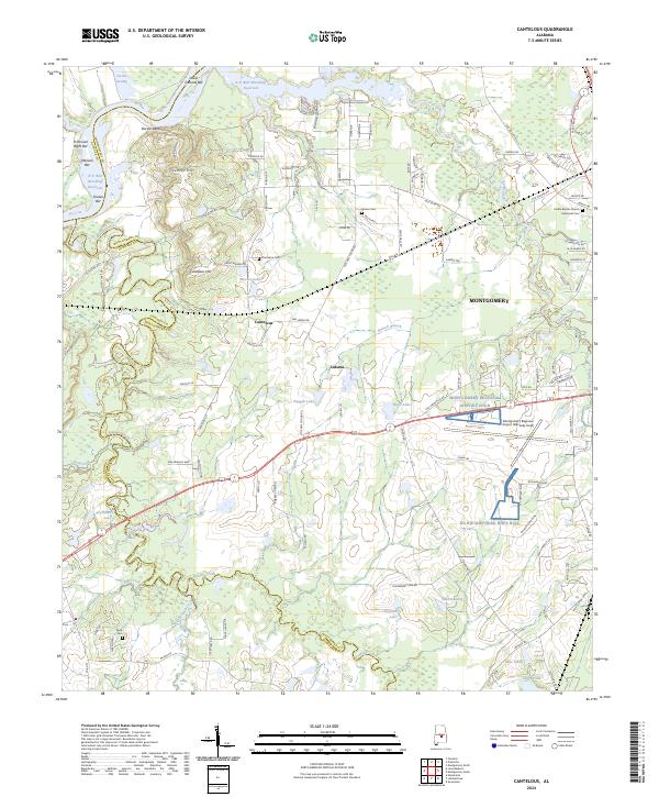
2024 Cantelous
Montgomery County, AL
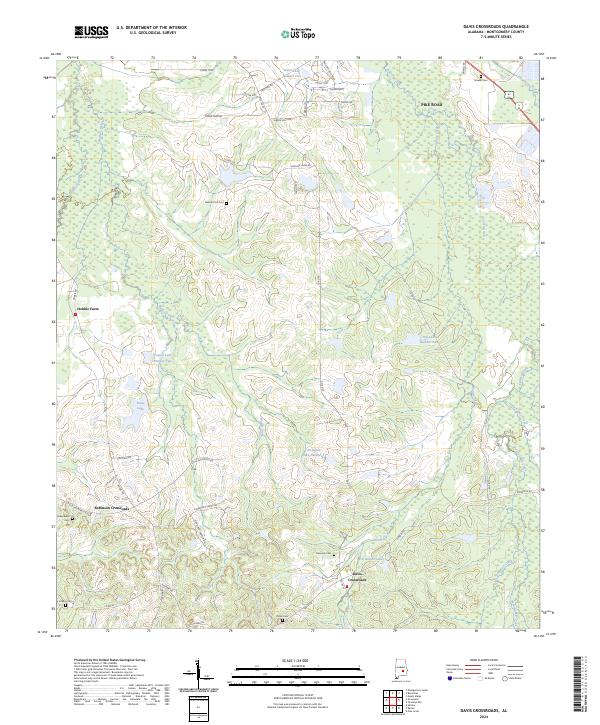
2024 Davis Crossroads
Montgomery County, AL
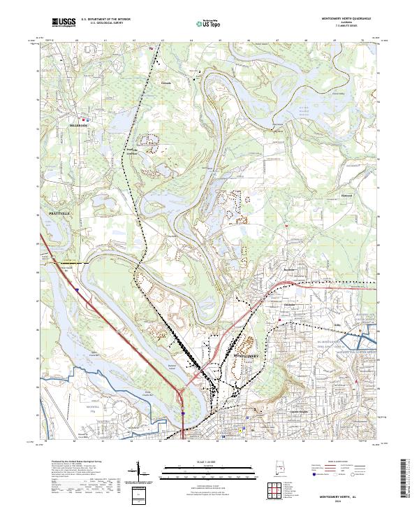
2024 Montgomery North
Montgomery County, AL
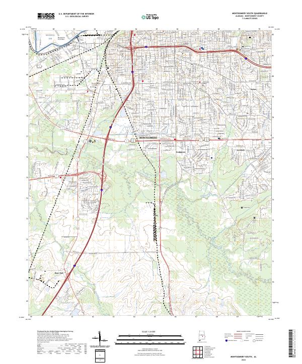
2024 Montgomery South
Montgomery County, AL
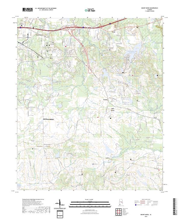
2024 Mount Meigs
Montgomery County, AL
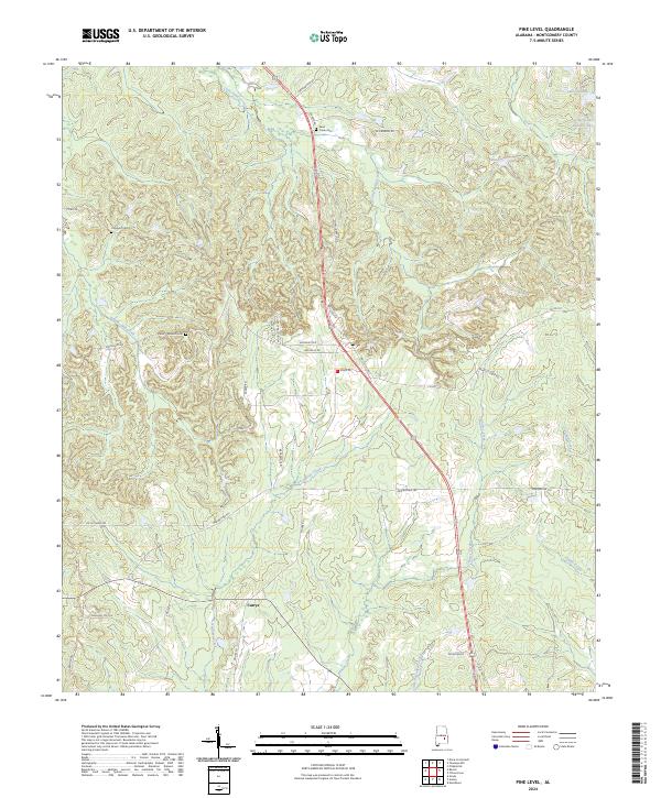
2024 Pine Level
Montgomery County, AL
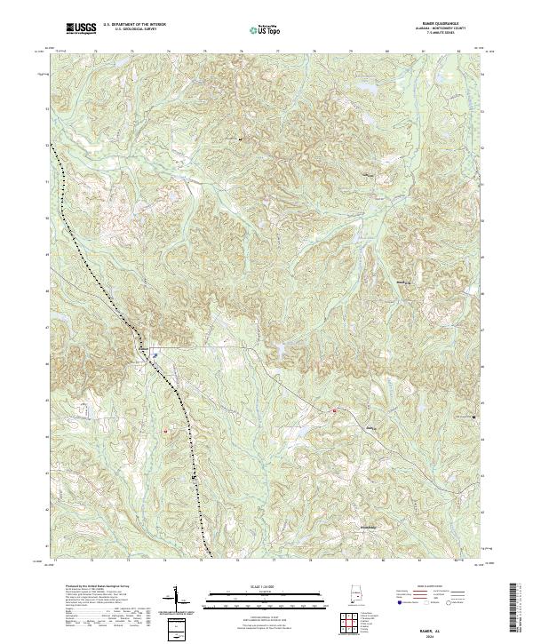
2024 Ramer
Montgomery County, AL
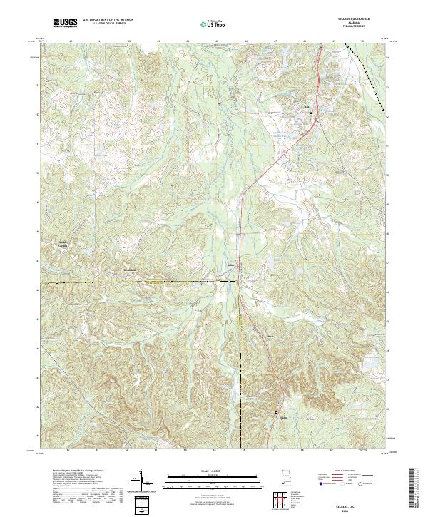
2024 Sellers
Montgomery County, AL
2024 Snowdoun
Montgomery County, AL
2024 Teasleys Mill
Montgomery County, AL
2024 Willow Springs
Montgomery County, AL