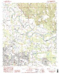
1987 Map of Willow Springs
USGS Topo · Published 1987About this map
The Tallapoosa River meanders through this landscape on the northeastern outskirts of Montgomery, marking the boundary between Montgomery and Elmore counties. In the late 1980s, the area reflects a transition from rural river bottoms and family landholdings to urban expansion. To the southwest, Montgomery East and the Gunter AF Station show dense residential and military development, while the northern reaches maintain a more dispersed character around Willow Springs and Old Bingham. Local genealogy and history are preserved in the numerous small burial grounds and rural houses of worship, such as Young Cem, Goodhope Cem, and Bethel Ch. Evidence of the region's industrial and agricultural activity is found in the scattered Gravel Pits and the expansive Brassell Bottom wetlands near Froggy Bottom Pond. Historical transit routes like the CSX railroad and Wares Ferry Road connect these outlying settlements to the growing city center.
Find a feature on this map
59 named features on this map. Tap any name to fly to it.
Don’t see what you’re looking for? This feature index may not catch every label — zoom into the map to look around manually.
Map Details
Editions of this 1987 Willow Springs Map
2 editions found
Other maps of this area

1901 · Wetumpka
USGS Topo · 1:125,000

1901 · Wetumpka
USGS Topo · 1:62,500

1903 · Wetumpka
USGS Topo · 1:125,000

1927 · Montgomery
USGS Topo · 1:48,000

1930 · Montgomery
USGS Topo · 1:62,500

1953 · Montgomery
USGS Topo · 1:250,000

1956 · Montgomery
USGS Topo · 1:250,000

1957 · Montgomery
USGS Topo · 1:250,000

1958 · Montgomery
USGS Topo · 1:62,500

1958 · Montgomery North
USGS Topo · 1:24,000