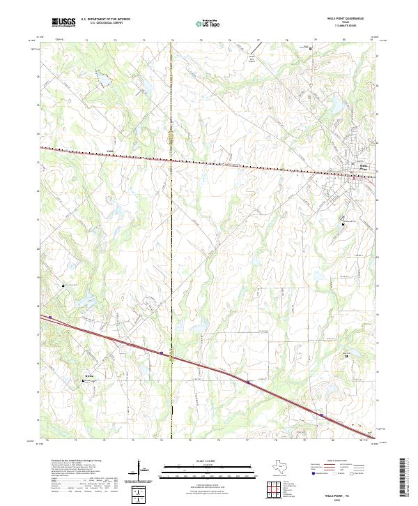
2022 Map of Wills Point
USGS Topo · Published 2022About this map
Wills Point serves as the primary hub in this eastern Texas landscape, situated at the intersection of a dense local road network and the historic corridor of W South Commerce St. The town's grid reflects a well-established community, while the surrounding Van Zandt and Kaufman County borderlands remain defined by small rural settlements and a series of family and community burial grounds. These include Union Grove Cem in the north and Locust Grove Cem near Hiram to the southwest, providing valuable touchpoints for genealogists. The terrain is intricately carved by numerous tributaries such as Rocky Cedar Creek and Wolf Cr, which flow through a mix of open land and wooded creek bottoms. The presence of the private Richie Rich Airport and the transition from smaller settlements like Cobb to the more structured environment of Wills Point illustrates the modern rural-urban balance in this portion of the Texas Blackland Prairies.
Find a feature on this map
86 named features on this map. Tap any name to fly to it.
Don’t see what you’re looking for? This feature index may not catch every label — zoom into the map to look around manually.
Map Details
Editions of this 2022 Wills Point Map
This is the sole edition of this map. No revisions or reprints were ever made.
Other maps of this area

1954 · Dallas
USGS Topo · 1:250,000

1956 · Tyler
USGS Topo · 1:250,000

1956 · Quinlan
USGS Topo · 1:62,500

1956 · Emory
USGS Topo · 1:62,500

1958 · Dallas
USGS Topo · 1:250,000

1962 · Myrtle Springs
USGS Topo · 1:24,000

1962 · Elmo
USGS Topo · 1:24,000

1962 · Cedarvale
USGS Topo · 1:24,000

1962 · Wills Point
USGS Topo · 1:24,000
1962 · Ola
USGS Topo · 1:24,000