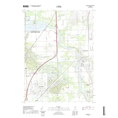
2018 Map of Wilmington
USGS Topo · Published 2018About this map
Braidwood and Wilmington anchor this study of the Illinois prairie, where the Kankakee River winds through a landscape transformed by industrial and recreational water management. The northern reaches are dominated by the Dresden Cooling Lake and the Illinois and Michigan Canal National Heritage Corridor, marking the intersection of historic transit and modern energy infrastructure. Notable river features like Mulberry Island and Grape Island sit near the County Line Bridge at the Will and Grundy county border.
Find a feature on this map
136 named features on this map. Tap any name to fly to it.
Don’t see what you’re looking for? This feature index may not catch every label — zoom into the map to look around manually.
Map Details
Editions of this 2018 Wilmington Map
This is the sole edition of this map. No revisions or reprints were ever made.
Other maps of this area

1892 · Morris
USGS Topo · 1:62,500

1892 · Wilmington
USGS Topo · 1:62,500

1918 · Wilmington
USGS Topo · 1:62,500

1918 · Morris
USGS Topo · 1:62,500

1923 · Herscher
USGS Topo · 1:62,500

1925 · Herscher
USGS Topo · 1:62,500

1948 · Dwight
USGS Topo · 1:62,500

1950 · Dwight
USGS Topo · 1:62,500

1953 · Coal City
USGS Topo · 1:24,000

1953 · Symerton
USGS Topo · 1:24,000