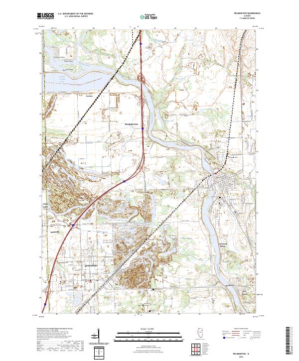
2024 Map of Wilmington
USGS Topo · Published 2024About this map
The Kankakee River winds through this Illinois landscape, passing several river-oriented communities and industrial features. Notable for its cluster of water bodies, the area includes the Dresden Cooling Lake in the northwest and a series of smaller lakes such as Big Shadow Lake and Dinosaur Lake, reflecting the region's post-industrial landscape. The settlement of Wilmington sits prominently on the riverbanks, while to the southwest, the communities of Braidwood, Coal City, and Diamond show the dense residential patterns characteristic of these former mining centers.
Find a feature on this map
77 named features on this map. Tap any name to fly to it.
Don’t see what you’re looking for? This feature index may not catch every label — zoom into the map to look around manually.
Map Details
Editions of this 2024 Wilmington Map
This is the sole edition of this map. No revisions or reprints were ever made.
Other maps of this area

1892 · Morris
USGS Topo · 1:62,500

1892 · Wilmington
USGS Topo · 1:62,500

1918 · Wilmington
USGS Topo · 1:62,500

1918 · Morris
USGS Topo · 1:62,500

1923 · Herscher
USGS Topo · 1:62,500

1925 · Herscher
USGS Topo · 1:62,500

1948 · Dwight
USGS Topo · 1:62,500

1950 · Dwight
USGS Topo · 1:62,500

1953 · Coal City
USGS Topo · 1:24,000

1953 · Symerton
USGS Topo · 1:24,000